Research Areas
Camera Cage
Introduction
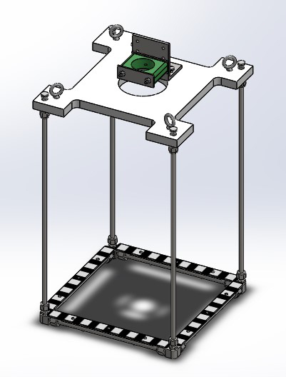 Schematic of fully assembled cage.
(Text is based on Pe’eri et al., 2013)
Remote-sensing data and tools are increasingly being used in supporting coastal ecosystem studies, coastal zone management, seafloor characterization, and ocean planning. However, a topic that often receives insufficient attention is the field component of calibration and validation of coastal remote-sensing data. As these data and derived coastal geospatial products are frequently used in supporting planning and policy decisions (e.g., coastal land use, coastal engineering projects, habitat protection, and restoration), it is imperative to be able to answer questions relating to the performance of various sensors under different environmental conditions and the level of detail that can be resolved by each sensor’s observations.
Complicating the calibration and validation of coastal remote-sensing data is the fact that the area of interest comprises both land features and submerged features. Because water transparency varies with wavelength and depth, it is difficult to relate even submerged features at different water depths. Many studies aim to integrate observations from different sensors (data fusion) and infer the seafloor facies and/or habitat classes, which can increase the amount and quality of information available, but further complicates the calibration and validation of the fused data sets.
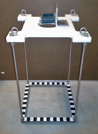 Photo of fully assembled cage.
Without significant meaningful ground control, coastal remote-sensing surveys are incomplete. In situ measurements are required as ground-truth to validate the data interpreted from airborne lidar bathymetry (ALB), hyperspectral imagery (HSI), and swath-sonar surveys. Ground-truth facilitates decoupling topographic and bathymetric surface characteristics (e.g., elevation or depth, rugosity, aspect, and slope) from the physical characteristics of the site (e.g., sediment type, submerged aquatic vegetation species, and abundance). Intensity and backscatter images may vary from one survey line to another because of changes in vehicle orientation, slope of the seafloor, angles of incidence, water clarity, and the tidal stage (water level).
The links below provide information on the Center for Coastal and Ocean Mapping (CCOM) in situ benthic sampling system that incorporates video imagery with spectral measurements, depth measurements, and GPS. The ability to simultaneously extract color and texture information at the same location makes the Optical Collection Suite (OCS) system a useful tool for adding baseline control points to data acquired from the ALB, HSI, and swath-sonar surveys in shallow water. The uses of and technical requirements for the OCS system are presented with the specifications of the components selected to satisfy those requirements. The system itself has been used in a number of coastal science and mapping applications since 2009.
• Pe’eri et al. 2013
• Camera Cage Mechanics (section 1 out of 2)
• Camera Cage Electronics and Image Acquisition (section 2 out of 2)


