Research Areas
D-Day 1944
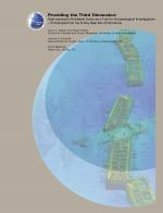
High-Resolution Multibeam Sonar as a Tool for Archaeological Investigations: An Example from the D-Day Beaches of Normandy
Contact:
Larry Mayer, Brian Calder, James Schmidt, Chis Malzone
Modern high-resolution multibeam sonar provides a new mapping tool for marine archaeological investigations. Complex seafloor targets may be mapped from a safe distance and the true three-dimensional (3-D) shape of the object can be resolved with centimeter-level resolution. This was clearly demonstrated in the summer of 2002 when the Naval Historical Center (NHC), the Center for Coastal and Ocean Mapping (CCOM) at the University of New Hampshire, and Reson Inc., collaborated to explore the state of preservation and impact on the surrounding environment of a series of wrecks located off the coast of Normandy, France, adjacent to the American D-Day landing sectors. This web page contains a paper describing theses surveys presented at the US 2003 Hydrographic conference held in Biloxi, Mississippi.
View a PDF version of this article: